Here are MANY history-related websites. Finding them is easy – the hard part is sorting through the information and verifying its accuracy. Much of our knowledge has been lost over time, and many surviving sources conflict with each other.
In this modern age, the Internet gives us access to information from other countries. You may notice that sites based in other countries (like Britain, Germany, China, Russia, Muslim countries, etc.) may have different information than US sites have available. Sometimes their data is better than ours, and sometimes it’s not.
Our Links section is only a list of the best history websites was found during research. This list is by no means the most comprehensive; there are already websites that database all the history links they find. They have a lot of information if you have time to dig through all of it. Hopefully, this list will save you some time.
Great Historical Map Sites
Animated Atlases:
- Atlas of World History
- Patrice Henrio. Histoire Mondiale (in French)
- Explore the Mediterranean
Static (non-animated) History Maps:
- John Nelson. Historical Atlas of the World
- Euratlas Maps of European History,
- Columbia University’s Maps of South Asia
General History Sites:
- The Xenophile Historian by Charles Kimball
- Macrohistory and World Report by Smitha
- Friesian School of Philosophical History
- Livius’ Ancient History Articles
- AllEmpires.com History Forum
- Bartleby’s Encyclopedia of World History (2000)
- Historical Map Resources on the University of Texas website
- Early British Kingdoms
Other links
A- Best History Sites
-
- Regnal Chronologies by Bruce Gordon
- Friesian – Philosophy of History
- Friesian Philosophy of History page
- Friesian – History of Philosophy
- Friesian History of Philosophy page
- All Empires – Homepage
- All Empires – History Forum
- The Xenophile Historian – general world history pages
- Xenophile Historian – Site Map
- Livius – Ancient History Articles
- Columbia-edu – (Early) Maps of South Asia History
- DSAL – Schwartzberg’s Historical Atlas of South Asia
- Schwartzberg Atlas, Digital South Asia Library
- The Digital South Asia Library
- The Digital South Asia Library provides dictionaries, gazetteers, photographs, prints, drawings, maps, statistics, bibliographies, indexes, books, and journals for reference and research concerning South Asia.
- Huhai maps – History & Commercial Atlas of China by Albert Herrmann, PhD
- Historical & Commercial Atlas of China, available on http://map.huhai.net
- Bellemare’s Historical Atlas of Late Antiquity – (Translated)
- FSmitha Macrohistory & World Report
- Nikolaev’s Atlas of World History – Всемирная история (Russian)
- Wikimedia Atlas of world history
- Wikimedia’s Atlas of world history
- Bartleby Encyclopedia of World History
- Internet History Sourcebooks Project by Paul Halsall – Fordham University
- Internet History Sourcebooks Project by Paul Halsall-Fordham University
- Internet Ancient History Sourcebook
- The Internet Ancient History Sourcebook
- Internet Medieval History Sourcebook
- Internet Medieval History Sourcebook
- History Wiki
- History Wiki is a database that anyone can edit.
- History Cooperative
- History Cooperative
- World History Network
- World History Association
- World History Resource Center (Wadsworth)
- EAWC Internet Index
- TurkicWorld – Maps
- Glorious India – History of India
- Historical Text Archives
- The Historical Text Archive publishes high quality articles, books, essays, documents, historical photos, and links, screened for content, for a broad range of historical subjects. The HTA is a collection of primary and secondary materials and links to other resources relating to history and culture.
- History Sites by Time Period (TNtech)
- Internet Resources in History (TNtech)
- AD Timeline (Anglefire)
- Best History Sites (AcesWebWorld)
- Best History Sites. Top History Sites. Award Winning History Sites. Great History Sites.
- The History Guide — Main
- The History Guide has been created for the high school and undergraduate student who is either taking classes in history, or who intends to major in history in college. The purpose of The History Guide is to better prepare yourself for your history classes and to make your time in class more enjoyable and proficient.
- Okeanos
- WHKMLA : World History at KMLA
- World History, Encyclopedic Description of History
- History Guide NG
A- B
-
- Atlas of the World History Maps
- Wikimedia Atlas of World History
- Columbia-edu – (Early) Maps of South Asia History
- Columbia-edu – (Overview) Maps of South Asia History
- DSAL – Schwartzberg’s Historical Atlas of South Asia – index
- Schwartzberg Atlas, Digital South Asia Library
- Euratlas – History and Geography of Europe
- Huhai maps – History & Commercial Atlas of China by Albert Herrmann, PhD
- Oddens’ Bookmarks – links to maps and mapping
- Halsall’s Internet History Sourcebooks Project (Fordham University)
- TurkicWorld – Maps
- MAPAS IMPERIALES (Imperial Maps)
- Nikolaev’s Atlas of World History – Всемирная история (Russian)
- Nikolaev’s Atlas of World History – Всемирная история (mirror site)
- Bellemare’s de l’Atlas historique de l’Antiquite tardive – index
- Bellemare’s Historical Atlas of Late Antiquity – (Translated)
- Nelson’s Interactive Historical Atlas – WorldHistoryMaps-com
- reisenett Historical Map Web Sites
- www-VL History Maps Index
- FSmitha Macrohistory – Maps
- Perry-Castañeda Library Map Collection – UT Library Online
- WorldHistoryMaps-com Historical Maps of the World for every year in recorded history
- A unique approach to historical Mapping. Historical maps of the world. One map for each and every year in recorded history. Interactive historical atlases on CD. Historical maps of the world since 500bce. Historical maps of North American since 1492. .
- Welcome to Avalon Maps
- Download digital world, continental, regional, decorative, and historical maps
- CU Dept. of Geography Resources: Map Collections
World History
Ancient
- AllRefer.com – Mongolia – Xiongnu and Yuezhi Mongolian Information Resource
- Internet Ancient History Sourcebook
- The Megalithic Portal and Megalith Map
- Ancient Atlas
- AncientWorlds
- Ancient History
- Ancient Civilizations – Tracing the Past
- Devoted to the study of Ancient Civilizations, the places, the people and events that have shaped the world as we know it today.
- Ancient World History
- Presents ancient world history sources and research on Mediterranean civilizations, historians, Greek, Roman, Phoenician, Egyptian museums and history associations
- Ancient World History of Civilizations
- Ancient world history sources and links, Mediterranean civilizations, historians, libraries, university associations
- Ancient World
- The origins of religions, civilization, empire, philosophy and the develop of religion to the fifth century. Forty-five maps.
- WWW-VL History: Ancient History In General | Selected Sites
- Hall of Maat – The Emergence of Civilizations to 500 BCE
- Discussing Alternative Archaeology, Science and History
- Ancient History Resources
- Ancient history research links for high school and college students
- Late Antiquity: A Guide to the … – Google Book Search
- Classical Atlas Project
- Livius. Articles on Ancient History
- Hellenistic Monarchs down to the Roman Empire
- Introduction Macedonian Great Kings Kings of Epirus The Bosporan Kingdom Antigonid Kings Kings of Thrace Kings of Macedonia Aetolian & Achaean Leagues Tyrants and Kings of Syracuse Consuls of the Roman Republic The Seleucids, Macedonian Kings of Iran, Iraq, Syria, etc. The Seven Wonders of the World Kings of Armenia Kings of Pontus Chiefs & Kings of Galatia Kings of Bithynia The Attalids of Pergamum Kings of Cappadocia Macedonian Kings of Bactria The Parthian Arsacids Leaders & Kings of Judaea Kings of Commagene Kings of Caria The Ptolemies, Macedonian Kings of Egypt Arabia Felix, Yemen at-Tababi’a Saba/Sheba Dhu-Raydan & Himyar
- Hellenistic Civilization
- The Atlas of Ancient and Classical Geography.
- Open Directory – Ancient History
- Open Directory – Science: Social Sciences: Archaeology: Periods and Cultures: Prehistory
- Oriental Institute | The Joint Prehistoric Project
- WWW-VL: History: Ancient Near East | Selected Near East Research Centers, Libraries, Ancient History Resources
- Ancient Civilizations
- The history of civilization is a long one. This sites take you way back into history to see human civilization as it first looked.
Medieval
- Early Medieval Cover Page
- Medieval Sourcebook Maps
- medieval_index
- Medieval History
- WWW-VL Medieval Europe
About-Medieval-com
- Medieval Atlas – World Maps – Medieval Maps of the World
- Medieval History – Past issues of weekly features archived by topic
- historical atlas – About.com : Medieval History
- Medieval History Forum
- About.com: https://www.oxuscom.com/cahist1.htm
- African Timelines Part I
- NetSERF: The Internet Connection for Medieval Resources
- NetSERF’s goal is to provide those interested in any aspect of the Middle Ages a single index of all the best medieval resources available on the Internet.
- The Medieval Academy
- A Medieval Atlas
- Medieval Atlas – Maps of Asia – Medieval Asia in Maps
- Medieval Atlas – World Maps – Medieval Maps of the World
- Medieval Atlas – Maps by Geographic Region
- Medieval Sourcebook Introduction
- Online Resources for Medieval Historians : Historical Studies : University of Leicester
- School of Historical Studies, University of Leicester, United Kingdom. A School acclaimed for its research and teaching, delivering high quality courses to undergraduate and postgraduate students, and contributing to major historical research in a wide range of areas.
- Open Directory – Medieval History
- Peoples of the Dark Ages
- Huns And Their Western Migration
- ByzNet Byzantine Studies on the Net Maps 650
- Site dedicated to resources and links relating to the Byzantine Empire.
- Grover Furr’s Medieval History and Literature Page
- Lost Medieval Village by Wharram Percy
- Labyrinth Home Page
- Medieval studies scholarly resources compiled and organized from around the world.
- The Labyrinth
Americas
Africa
- Applied History Research Group – Multimedia History Tutorials
- Saudi Aramco World Libya’s Forgotten Desert Kingdom
Egypt
- http–www.digitalegypt.ucl.ac.uk-chronology-index.html
- Ancient Egyptian Culture (mnsu)
- An exhibit in the MSU EMuseum which has information on the culture of ancient Egypt. This site includes information on architecture, art, hieroglyphics, the daily life of ancient Egyptians, military and maps.
- The History of Ancient Egypt (mnsu)
- An exhibit in the MSU EMuseum, which has information on the history of ancient Egypt, including Dynasties, significant people, time-frames, dates and maps. It gives a brief explanation of the political history for each time period.
- Egypt Links (mnsu)
- The Ancient Egypt Site – The History, Language and Culture of Pharaonic Egypt
- The history, language and culture of Ancient Egypt by Egyptologist Jacques Kinnaer
- WWW-VL: History: Ancient Egypt History | Egyptology, Hieroglyphs, Pyramids, Sphinx, King Tut, Egypian, Brugsch
Asia
East Asia
- History sites for East Asia, including China, Korea, and Japan
- Ethnic Minorities of China – China History Forum
- Chinese History Forum . com
- Chinese History Forum
- History & Commercial Atlas of China – map.huhai.net
- Chinese History (www.chinaknowledge.de)
- Hier beschreiben Sie mit ein, zwei Sätzen den Inhalt dieser Datei.
- China Historical GIS
- 30-31.jpg (JPEG Image, 1987×1686 pixels)
- 34-35.jpg (JPEG Image, 1914×1637 pixels)
- Internet East Asian History Sourcebook
- Wiki Korean History maps by Park Hyeon
- RepublicanChina.org homepage
- CHINA political, social, cultural, and historical analysis by RepublicanChina.org
- China – mnsu
- List of tributaries of Imperial China: Facts, Discussion Forum, and Encyclopedia Article
- Maps of China
- Timeline and Maps of China from Historical to Present
- Timeline of Chinese history, historical and current maps of China
- http://www.chinapage.com/main2.html
- History of China by Wolfram Eberhard
- China history (Chinawikipedia)
- The Cambridge history of ancient … – Google Books
- Encyclopedia of Prehistory: East … – Google Books
- Ethnic groups in Chinese history – Wikipedia, the free encyclopedia
- Chinese History – Foreign peoples in and around China (www.chinaknowledge.de)
- Hier beschreiben Sie mit ein, zwei Sätzen den Inhalt dieser Datei.
- The Cambridge history of ancient … – Google Books
- Ancient China and its enemies: the … – Google Books
China
- 1 Chinese Prehistory — Political, Social, Cultural, Historical Analysis Of China
- Chinese
- China Research Page by History Link 101
- Links to sites on Chinese History, Timelines, Biographies, and more.
- Chinese history, timelines, maps, and Chronology of dynasties and emperors
- detailed Chinese history main page books on history
- The Chinese Empire (wsu.edu)
- Maps of China
- Maps of China and Asia Ditu 地图
- Collection of various maps of China, ranging from province maps, city maps ,ancient, historical, to special and topical maps. Ditu 地图
- Ancient China (mnsu)
- This exhibit contains information on the culture and history of ancient China including architecture, art, military and maps.
- China Map Page by History Link 101
- Links Chinese maps on the web.
- History of China: Table of Contents (chaos.umd)
- China History Timeline (chaos.edu)
- History of China (Chaos.umd.edu)
- Chinese Cultural Studies: Concise Political History of China
- Links to Chinese Studies Sites (PHalsall)
- China : Country Studies – Federal Research Division, Library of Congress
- China : Country Studies – Federal Research Division, Library of Congress
- Chinese Culture Page (Brooklyn College)
- Maps of China and Asia Ditu 地图
- Collection of various maps of China, ranging from province maps, city maps ,ancient, historical, to special and topical maps. Ditu 地图
- Internet Resources: China (wsu)
- Chinese Historical Society of America | Home
- The Chinese Historical Society of America is the largest established institution dedicated to the study, documentation, and dissemination of Chinese American history.
- Chinese Classical Historiography
- WWW-VL: HISTORY: CHINA
- Links to Sites for Chinese Studies
- Marjorie Chan’s ChinaLinks – ChinaLinks.osu.edu
- Marjorie Chan’s ChinaLinks, China, Chinese, Chinese culture, Chinese language, Chinese linguistics, Chinese search engines, Chinese software, Chinese dialects, Chinese dialectology, Chinese search engines, Chinese netnews, Chinese web radio, Chinese e-texts, Cantonese, DEALL
- UCSD Modern Chinese History Site
- Ancient China (wsu)
- Chinese Dynasty Guide – The Art of Asia – History and Maps
- An online project for museum visitors, teachers, students, and everyone interested in Asian art, culture, and history featuring objects from The Minneapolis Institute of Arts’ permanent collection.
- Teaching Chinese Archaeology, Part Three – NGA
- Teaching Chinese Archaeology, Table of Contents – NGA
- University of Mass Amherst | Warring States Project
- OLD WESTERN MAPS OF JAPAN
- Wolfgang Michel: OLD MAPS OF JAPAN
- Japanese History
- History of Japan.
- Digital Librarian: Japan
- Guide to Japanese Historical Periods – The Art of Asia – History and Maps
- An online project for museum visitors, teachers, students, and everyone interested in Asian art, culture, and history featuring objects from The Minneapolis Institute of Arts’ permanent collection.
Southeast Asia
- Southeast Asia (Indo-China), including modern Vietnam, Cambodia, Laos, Burma, Indonesia, etc.
- VIET NAM (vietnam) © 1996-2007 viettouch.com
- about Viet Nam, ancient Viet Nam
- Khmer Studies . org
- Malaysian Timeline
- SE Asia Beginnings to 1500: Ancient Kingdoms and the Coming of Islam
- Timeline of Indonesian history – Wikipedia, the free encyclopedia
- HISTORY OF SOUTH EAST ASIA
- ASIA SE SAGA : the amazing history of south east asia… Since prehistory until today… Illustrated with more than 27 maps
- Prehistory of the Indo-Malaysian … – Google Books
- The birth of Vietnam – Google Books
- WWW Hmong Homepage
- WWW Hmong Homepage contains of resources relating to Hmong history, culture, language, and current events.
- Ban Chiang
- Indo-Pacific Prehistory Association
- Vietnam, past and present – Google Books
- A History of Vietnam: From Hong Bang … – Google Books
- Southeast Asia: from prehistory to … – Google Books
- The Austronesians: historical and … – Google Books
- A History of Vietnam: From Hong Bang … – Google Books
- The bronze age of Southeast Asia – Google Books
- History of Hundred Yue People – China History Forum, Chinese History Forum
- China History Forum is an online chinese history forum for people who are interested in learning and discussing chinese history, including Chinese Art of War, chinese culture topics
- Yue peoples (Zhuang 02)
- Zhuang Index (Jeff Barlow)
- Qin Conquest of Yue peoples (Zhuang 03)
- Prehistory of the Indo-Malaysian Archipelago by Peter Bellwood at Questia Online Library
- Prehistory of the Indo-Malaysian Archipelago
Yue Peoples
- China History Forum, Chinese History Forum -> Prehistory to Qin
- China History Forum, Chinese History Forum -> Chinese Ethnic Groups and Peoples
- index.php (JPEG Image, 480×300 pixels)
- Got a question about ethnicities? – China History Forum, Chinese History Forum
- History of Hundred Yue People – China History Forum, Chinese History Forum
- Zhuang 03
- Institute of Vietnamese Studies – Viện Việt Học
Yue Peoples 2
- Yue peoples – Google Books
- Wuhu – Wikipedia, the free encyclopedia
- The birth of Vietnam – Google Books
- Vietnam, past and present – Google Books
- Southeast Asia: from prehistory to … – Google Books
- A History of Vietnam: From Hong Bang … – Google Books
- A History of Vietnam: From Hong Bang … – Google Books
- 18-19.jpg (JPEG Image, 2250×1712 pixels)
- Zhuang people, Luo Yue people – China History Forum, Chinese History Forum
- Yue peoples – Wikipedia, the free encyclopedia
- Văn Lang – Wikipedia, the free encyclopedia
- Vietnam Early History
- Southeast Asia in the Ming Shi-lu – home
- The kettledrums of Southeast Asia: a … – Google Books
- Southeast Asia: from prehistory to … – Google Books
Greater India
- History websites for Greater India, including modern India, Pakistan, Bengal, and Nepal.
Indo-Greeks
- Greco-Bactrian Kingdom at AllExperts
- Indo-Greek Kingdom at AllExperts
- History of Civilizations of Central Asia – Google Book Search
- http–www215.pair.com-sacoins-images-maps-indo_greek.gif
- Image talkEast-Hem 100bc.jpg – Wikimedia Commons
- ImageEast-Hem 100bc.jpg – Wikimedia Commons
- ImageIndo-Greeks 100bc.jpg – Wikimedia Commons
- ImageIndoGreekCampaings.jpg – Wikimedia Commons
- Index of -sacoins-images-maps
- Indo-Greek Kingdom – Wikipedia, the free encyclopedia
- Indo-Greeks map – Google Search
- Indo-Scythians at AllExperts
- Iranica.com – INDO-GREEK DYNASTY
- My watchlist – Wikipedia, the free encyclopedia
- User talkTalessman – Wikipedia, the free encyclopedia
- Greco-Bactrian Kingdom
- Eucratides – Encyclopaedia Iranica
- the most extensive compendium ever conceived on the past and present culture of the peoples who speak an Iranian language and their contribution to the broader history of human civilization.
- Indo-Greek Dynasty – Encyclopaedia Iranica
- the most extensive compendium ever conceived on the past and present culture of the peoples who speak an Iranian language and their contribution to the broader history of human civilization.
- Euthydemus – Encyclopaedia Iranica
- the most extensive compendium ever conceived on the past and present culture of the peoples who speak an Iranian language and their contribution to the broader history of human civilization.
- Bactria – Encyclopaedia Iranica
- the most extensive compendium ever conceived on the past and present culture of the peoples who speak an Iranian language and their contribution to the broader history of human civilization.
- Bactria, the History of a Forgotten … – Google Book Search
- History of Civilizations of Central Asia – Google Book Search
- Kingdoms of South Asia – Indo-Greek Kingdom
- Kings of the Far East
- History of Greco-India (grecoindian)
- Greco-Indian influences on the West
- Welcome (grecoindian)
- Greco-Indian influences on the West
- A Concise History of India, Chapter 2 (Xenohistorian)
- The Classical Age of Indian Civilization: 500 B.C to 600 A.D.
- A Concise History of India, Chapter 1
- Dravidians and Aryans: India before 500 B.C.
- Maps of South Asia an organized collection
- Medieval maps on Columbia U
- b. Deccan and Western India. 2001. The Encyclopedia of World History
- C. Early Civilizations and Classical Empires of South and East Asia. 2001. The Encyclopedia of World History
- C. Early Civilizations and Classical Empires of South and East Asia. 2001. The Encyclopedia of World History
- 2. South Asia, 72 B.C.E.-500 C.E. 2001. The Encyclopedia of World History
- 2. South Asia, 72 B.C.E.-500 C.E. 2001. The Encyclopedia of World History
- 3. Southeast Asia, c. 500 B.C.E.-500 C.E. 2001. The Encyclopedia of World History
- Internet Indian History Sourcebook
- History of Ancient India – Google Books
- Ancient Indian History and Civilization – Google Books
- Ancient India: From the Earliest … – Google Books
- Ancient India – Google Books
- The Early History of India from 600 … – Google Books
- The Early History of India from 600 … – Google Books
- History of Civilizations of Central Asia – Google Books
- banglapedia Samatata
- Bhatinda – Google Search
- categoryMaps of the history of India – Wikimedia Commons
- EXPLORE IT
- Free History Study material,IAS History Notes,Study material for Ancient India History
- History of Pakistan
- http–www.geocities.com-pak_history-maps.html
- India history to 1526 – Hutchinson encyclopedia article about India history to 1526
- Indohistory-History_of_India-gupta_empire
- Indohistory-History_of_India-index
- The Chutus
- India – History (southasianist.info)
- History of India . com
- Pakistan Ancient History
- Pakistan History Page
- Contains detailed information on the history of Pakistan and North Western India from the Indus Valley Civilization to the modern ages.
- Pak History – History of Pakistan – South Asia – Facts – Historical Facts
- Pak History is dedicated to truthful projection of history of Pakistan, history of South asia and history of Muslims in South asia
- History of India
- History of India – Information on Indian history, Ancient History, Medieval History, Contemporary History of India
- Kushan Empire (AncientPakistan.info)
- Educational site covering 9000 years of Pakistani history. From the Ancient Indus Valley, to all the major empires that arose in Pakistan; Gandhara, Mughal Empire, Kushun Empire, and the more recent history of the Independence of Pakistan
- The Sakas (Ancient Pakistan)
- Educational site covering 9000 years of Pakistani history. From the Ancient Indus Valley, to all the major empires that arose in Pakistan; Gandhara, Mughal Empire, Kushun Empire, and the more recent history of the Independence of Pakistan
- India, History of India, About India, Indian Culture, Indian History, Indian Legends, Indian Population, Indian Religion, Indian Topography
- Discover the various facets of India in this site. Its legends, history, topography, climate, economy, industries, business, populations etc. are covered in detail here. History of India is a detailed information resource on Indian history
- IranChamber – History of Iran – India’s Parthian Colony
- Iranian Historical & Cultural Information Center
- Gandara – Livius
- HISTORY OF INDIA – IndianChild-com
- History of India. Useful Guide.
- DSAL – Schwartzberg’s Historical Atlas of South Asia – map 057 (Post Mauryan India)
- History : India : Selected Internet Resources (Portals to the World, Library ofCongress)
- Selected Internet Resources: India Portals to the World contain selective links providing authoritative, in-depth information about the nations and other areas of the world. They are arranged by country or area with the links for each sorted into a wide range of broad categories. The links were selected by Area Specialists and other Library staff using Library of Congress selection criteria. When completed, the project will include all the nations of the world.
- Wiki Timeline of Indian history
- Timeline of India Across the Ages
- The Digital South Asia Library
- The Digital South Asia Library provides dictionaries, gazetteers, photographs, prints, drawings, maps, statistics, bibliographies, indexes, books, and journals for reference and research concerning South Asia.
- Sri-Lanka – A Short History
- A short history of Ceylon by H. W. Codrington from 543 B.C. to 1833 A.D. published in 1926 OCR edited and cross-linked to an E-book with some color images and a growing number of hyper-links to URL’s with more detailed information on selected topics.
- Sri-Lanka PRE- AND PROTOHISTORIC SETTLEMENT IN SRI LANKA
- Sri-Lanka history – Chapter I
- Ancient Civilizations Timeline
- Ancient Time Line 4000-1000 B.C.
- The British Association for South Asian Studies
- The Society for South Asian Studies
- The ANCIENT INDIA & IRAN TRUST. Cambridge, England.
- Internet Indian History Sourcebook
- Historical Maps of India
- Maps of pre-independance India
- SARAI: South Asia Resource Access on the Internet
- South Asian History
- Ancient India (mnsu)
- Ancient India links (mnsu)
- Open Directory – South Asia History
Central Asia & Steppes
- History sites for Central Asia and the Steppes
- Steppe History Forum
- Migration of Yuezhi thru Sogdia – Transoxiana (Benjamin)
- Central Asia after Alexander, before Islam Abstract (British Academy Rapin)
- Huns
- History of Civilizations of Central Asia – Google Book Search
- Khazar Historic Maps
- Khazaria.com – History of the Khazars
- Kushan history, a rough guide to India, Afghanistan, Pakistan and eastern Iran
- Iranica – Central Asia
- History of Civilizations of Central Asia – Google Book Search
- Hun 0dateline En
- AD 460BulgarsIrnikEn.gif (GIF Image, 800×756 pixels)
- Central Asian History, Yueban – Google Search
- All Empires Forum: Search Results: Yueban
- International History Forum. Discuss and debate History, Religion and Current Affairs with people from all over the world
- Afghanistan Empires
- Bhuddism – Historical, Cultural, and Comparative Studies
- Chapter 4- Iran, India, and Inner Asia to 200 A
- History of Central Asia
- Iranian Huns, page 1
- OZTURKLER – Turkish Turan History
- http://www.turkicworld.org/
- Mongolian History Resources
- Hephthalites OR Kidarites OR “White Huns” -Wikipedia – Google Search
- HARGITA – How It Was? – Khwarezm
- The Ancient Identity of Hungarians – Khwarezm
- Transoxiana Webfestschrift Series 2003
- Webfestschrift Eran ud Aneran, studies
- Coins of Central Asia – Home page
- Этот сайт посвящён монетам, имевшим хождение на территории домусульманской Центральной Азии.This site is dedicated to coins which circulated in the territory of pre-Islamic Central Asia
- Early Medieval History and Coins of Central Asia – Index
- Early Central Asian Kingdoms, page 1
- The Red Kaganate
- The Red Kaganate is an association of historic reenactors, living history participants, people who do historic recreation with a focus on Eastern Europe, Western Asia, and Central Asia. Such nations and tribal groups as Russia, the Russ, Turkey, Turkmen, the Ghuz, the Khazars, the Magyars, the Uighur, Persia, India, Hungary, with secondary interests in China and the Middle East (including Arabs and Jews).
- Alans
- Steppe History Forum – Nice Sites
- History Forum ~ All Empires: Steppe Nomads and Central Asia
- weilue.html
- Kangju, Central Asia – Google Search
- Silk Road Diplomacy
- AFGHANS: Their History and Culture
- Golden Horde Khans
- CHIONITES (iranica.com)
- CHIONITES (RED HUNS) Article Summary
- CHIONITES RED HUNS From the Middle Persian word xiyon Hun a Hunnic tribe that began encroaching upon the frontiers of Iran and the the Kushan
- TWF: The Huns
- Research Thread: The Huns INVASIO BARBARORVM (IBFD) (BI)
- The Red Kaganate
- The Red Kaganate is an association of historic reenactors, living history participants, people who do historic recreation with a focus on Eastern Europe, Western Asia, and Central Asia. Such nations and tribal groups as Russia, the Russ, Turkey, Turkmen, the Ghuz, the Khazars, the Magyars, the Uighur, Persia, India, Hungary, with secondary interests in China and the Middle East (including Arabs and Jews).
- T R A N S O X I A N A :: Journal Libre de Estudios Orientales
- TRANSOXIANA, Journal Libre de Estudios Orientales
- GoogleBooks – Inner Eurasia from Prehistory to the Mongols
- Huns (smso)
- Saudi Medical Site Online, Medical Fourm, Magazin, news and library
- All Empires – The hepthalites & huns – Page 1
- I want to know about “Jabila tha Hun”, as many casts and many important towns (more than 10…
- THE IRANIAN: Sogdiana
- White Huns (Hephthalites)
- The Hephthalites of Central Asia – by Richard Heli
- History of the White Huns / Hephthalites in Gandhara. The Treasures of the Kashmir Smast – Mardan, Pakistan. Antiquities of Pakistan, Waleed Ziad
- The Coins and Antiquities of Pakistan from the Ancient and Classical Periods – Copyright Waleed Ziad, 2007. The Kashmir Smast project.
- Ephthalites – LoveToKnow 1911
- Kushan Rule
- Afghan Profile – Origins of the Afghans (Pashtuns)
- Afghan Profile – Fascism on Spot
- The Silk Road: Trade, Travel, War … – Google Book Search
- The Seleucid, Parthian and Sasanian … – Google Book Search
- GoogleSearch: Hephthalites OR Xionites OR Chionites – Google Search
- West Central Asia 380 AD Antiquite tardive
- West Central Asia 540 AD Antiquite tardive
- Caspian Steppes in 380 AD Antiquite tardive
- Caspian Steppes in 380 AD Antiquite tardive 2
- Caspian Steppes in 540 AD Antiquite tardive
- The Later Kushanas
- The Later Kushanas
- Warring King | Maodun War King | The Jade Road- Expert source Ancient Jades and Rarities
- A Silk Road Timeline – Timeline Index
- The “Silk Road,” a 4000 mile-long network of interconnecting roads, or caravan tracts, served from ca. 500 BC to 1500 A.D. as the major highway for transporting material goods and knowledge between Europe, the Near East, India, and China — the four m
- The Tajikistan Update – Historical Maps of Central Asia
- News, Articles, Maps, Discussion lists, Chat Rooms, and homepages concerning Central Asia and Tajikistan
- TURKMEN HISTORY
- Tocharian – Everything You Wanted to Know about Tocharian
- Khazar Historic Maps
- Sabir people – Wikipedia, the free encyclopedia
- Bactria – Livius
- Scythians – Livius
- Central Asia South – Regnal Chronologies
- China History Forum, Chinese History Forum (Powered by Invision Power Board)
- China History Forum is an online chinese history forum for people who are interested in learning and discussing chinese history, including Chinese Art of War, chinese culture topics
- Transoxiana Links and Resources
- TRANSOXIANA, Online Refereed Journal on Asian Studies, Publicacion Electronica Refereada sobre Estudios Orientales – hosted by iBiblio
- Asii or Asiani – Encyclopaedia Iranica
- the most extensive compendium ever conceived on the past and present culture of the peoples who speak an Iranian language and their contribution to the broader history of human civilization.
- History of Ancient India – Google Book Search
- UNESCO Collection of History of Civilizations of Central Asia
- Greco-Bactrian Kingdom – Wikipedia
- Bactria, the History of a Forgotten … – Google Book Search
- History of Civilizations of Central Asia – Google Book Search
- Kingdoms of Persia – Bactria
- Kings of the Middle East
- Kushan History, the Chinese and the Yu-chi
- Maps for Central Asia? – Steppe History Forum
- History of the Yuezhi China History Forum
- Hun & Huns — Political, Social, Cultural, Historical Analysis Of China — Research Into Origins Of Huns, Uygurs, Mongols And Tibetans
- Chinese
- Timur and Timurids
- Central Asia during the early Middle Ages – Introduction
- Khazaria – Turkic Republics and Communities – Turks, Turkish, Turk
- Oxus.com – Central Asia Pages
- Oxus.com – Websites on Central Asia
- ECAI Silk Road Atlas – Empires
- Welcome to the Turkish World!
- Silk Road to China – Websites (ChinaPage)
- Silkroad to China. Dunghuang Grottoes. Arts, Fresco, History, Maps
- The Silk Road (Oliver Wild)
- The Silk Road (Oliver Wild)
- The history of Central Asia
- The history of Central Asia
Iran
- Iranian History websites
- History of Iran Historic Periods & Events
- PersianEmpire.info History of the Persian Empires
- Regnal Chron—Central-Asia-South
- Encyclopaedia Iranica
- The Sassanids, to 500 CE (FSmitha)
- Bahram II and Narseh; Shapur II (the Great); More persecutions, tolerance and war, to the mid-400s; A Communist Revolution.
- Parthian Empire vs Han China – Chinese History Forum
- iranian.com: History
- Iranian diaspora, Iranian Persian Poetry, The Shame, Arash Daneshzadeh
- The History of Iran – Google Book Search
- The History of Afghanistan – Google Book Search
- Persia – Livius.org
- History of Afghanistan
- History of ancient and modern Afghanistan
- Parthians – Encyclopaedia Iranica
- the most extensive compendium ever conceived on the past and present culture of the peoples who speak an Iranian language and their contribution to the broader history of human civilization.
- Parthia – History of Parthia
- History of the Indo-Parthians
- Kingdom of Sakas soon fell into the hand of a Pahlava ruler Gondophares and then started a new era of Indo-Parthians
- The Seleucid Empire (Syria)
- Parthia (2): the empire – Livius
- Bactria (search) – Encyclopaedia Iranica
- Mithradates 1 – looklex-com
- King
- Parthian Dynasty – looklex-com
- .
- History of Iran: Parthian Empire
- Iranian Historical & Cultural Information Center
- Parthian Web Links of Interest
- Parthia: The Parthian Empire – Ancient history and coins of Parthia
- Tillya Tepe – Wikipedia
- History of Civilizations of Central Asia – Google Book Search
- Iransaga – Persia or Iran, a brief history
- Persia or Iran, the history pre-twentieth century
- Iransaga – Persian Art, The Parthians
- Iranologie.com: Arsacid Empire, Chapter I
- History of Iran: Iranologie.com
- Iranology.com, dedicated to the academic study of the Iranian culture and history
- The Persians – Google Book Search
- Iran – AncientBackground
- The Persians – Google Books
- The Early History of India from 600 … – Google Book Search
- History of Civilizations of Central Asia – Google Book Search
- The Origin of Pre-Imperial Iranian Peoples
- Achemenet
- Image Map of Parthian Empire
- Parthia Home
- The Persians (wsu)
- The last great empire in Mesopotamia, the Persians were an Indo-European people from the north of Mesopotamia. After conquering Mesopotamia, the Persians would dominate the world from Macedon to Egypt, from Palestine to India and especially through their religion, Zoroastrianism, would have one of the most significant influences on world culture of all the Mesopotamian peoples.
West Asia
- Turkey, Syria, Israel, Arabia, Caucasia, etc.
- Ghassanids – Wikipedia, the free encyclopedia
- Historical maps of the Arab world
- Internet Islamic History Sourcebook
- Iran Chamber
- IslamiCity.com – Education
- Lakhmids – Wikipedia, the free encyclopedia
- maps – fsmitha
- NESTORIAN TIMELINE
- Other Maps Relating to Islam’s Historical Development
- Parthian Empire – Parthia,com
- THE NESTORIAN PAGES
- ANCIENT ANATOLIA AND ASIA MINOR
- Mesopotamia
- Middle East Studies Internet Resources
- The Middle East and Inner Asia A WWW Research Institute
- A General History of the Middle East, Table of Contents
- Contents for A General History of the Middle East.
- A General History of the Near East, Chapter 7 (Xenohistorian)
- In the Shadow of Rome: the Near East from 63 B.C. to 226 A.D.
- About-com = Maps Near East
- Robert H. Hewsen: Armenia
- Robert H. Hewsen, Armenia: A Historical Atlas
- Turkish Odyssey/About Turkey/History
- Wiki Timeline of Middle Eastern history
- Ancient Arabia
- Timeline Oman
- https://nabataea.net/
- https://nabataea.net/nab6.html
- Hittites.info – Home Page
- File:Urartu610-585.png – Wikimedia Commons
- Urartu – Wikimedia Commons
- Maps
- Iraqi History Page
- History of the Ancient Near East Table of Contents
- History, Ancient Near East, Ancient Middle East, Prehistoric, Africa, Asia Minor, Mediterranean, Persian Gulf, Iraq, Israel, Egypt, Turkey, Lebanon, Syria, Jordan, Arabia, Cyprus, Bahrain, Iran, Mesopotamia, Levant, Mashriq, Anatolia, Lisan Lake, Jazirah, Jazireh, Yazirah, Sumer, Shinar, Akkad, Accad, Agade, Old Babylonia, Neo-Babylonia, Chaldea, Hurrian, Mitanni, Assyria, Subartu, Canaan, Palestine, Esdraelon, Dead Sea, Wadi Arabah, Hebrews, Samaria, Israelites, Philistines, Philistia, Phoenicia, Arameans, Aramaeans, Nabateans, Ammonites, Edomites, Moabites, Hyksos, Nubia, Anatolia, Hittites, Lycia, Phrygia, Lydia, Zagros, Guti, Lullubi, Kassites, Parthia, Persia, Elam, Susiana, Media, Medes, Amorites, TransCaucasus, Urartu, Ararat, Armenia, Kurdistan, CisCaucasus, Cimmerians, Scythians, Cyprus, Bahrain, Bit-Adini
- Phrygian Period in Anatolia
- A general layout of Anatolia during the Phrygian rule
- Historical Background for Anatolia and Asia Minor
- This web site provides information on ancient History and Archaeology of Asia Minor and Anatolia
- The Islamic World to 1600
- History Of Cappadocia
- Brif History of Cappadocia
- Jewish Historical Maps and Atlases
Mongolia
- History of Central Asia
- Kushan history, a rough guide to India, Afghanistan, Pakistan and eastern Iran
- Silk Road Diplomacy
- Internet Indian History Sourcebook
- Internet Indian History Sourcebook
- The Chinese Empire (WSU)
- Arabic, Islamic and Middle Eastern Resources – University of Exeter Library and Information Service
- Services and facilities at the Library and Information Service of the University of Exeter, UK.
- THDL – Tibetan History: General Chronology
- Sejarah Melayu: A History of the Malay Peninsula
- Sejarah Melayu: A History of the Malay Peninsula
- Students for a Free Tibet : History and Culture
- Until 1949, Tibet was an independent Buddhist nation in the Himalayas which had little contact with the rest of the world. It existed as a rich cultural storehouse of the Mahayana and Vajrayana teachings of Buddhism. Religion was a unifying theme among the Tibetans — as was their own language, literature, art, and world view developed by living at high altitudes, under harsh conditions, in a balance with their environment.
- The Official Website of the Central Tibetan Administration
- Tibetan Government Official Website with news, Tibetan Newpapers and Magazines Online, multilingugal, offices introduction
- Tibet Online
- Portal to Asian Internet Resources – Directory: History
- Timeline
- History Section
- Google Image Result for http://bp0.blogger.com/_sG5NH12JsUo/R9kV127KtXI/AAAAAAAAADA/dHoHkGkujwc/s320/huns.jpg
- Avars – Total War Center Forums Research Thread
- Research Thread: Avars East of Rome (EOR)
- AVARS – Total War Center Forums 2
- Research Thread: AVARS Bulgaria: Total War (BGTW)
- The Sassanid Empire
- Historical maps of Pakistan region
- Welcome to Turkmenistan
- Tourism and travel
- Welcome to Turkmenistan
- Tourism and travel
- General information
- The World Wide Web Virtual Library: Transoxiana – Draft
- Transoxiana WWWVL: An anotated collection of
- WWW-VL History Index for Central Asia
- The World Wide Web Virtual Library: Transoxiana – Draft
- Transoxiana WWWVL: An anotated collection of
- WhiteHuns » home
- Huns
- Mongols MAPS
- ECAI Cultural Atlas Browser
- ECAI Silk Road Atlas – Empires
- ECAI Silk Road Atlas
- Encyclopaedia of the Orient
- Notes to the Wei lue
- The Silkroad Foundation – silk-road.com
- Who are the Assyrians
- The Seven Great Monarchies, by George Rawlinson, The Sixth Monarchy
- The Silk Road Virtual Art Exhibit
- Steppe History Forum – Search Results
- History and Commercial Atlas of China
- AllRefer.com – Mongolia – Xiongnu and Yuezhi Mongolian Information Resource
- CSEN Center for Study of Eurasian Nomads
- The Han Histories
- Asian Studies WWW VL
- Asian Studies WWW Virtual Library
- The Historical Mongol Empire
- Portal to Asian Internet Resources: Search Results
- Columbia U Maps of Asia History (early_index)
- Chronology of Ancient India: The Era of the Kushan King Kanishka
- Scythianss-blogspot-com
- The Tatar Gazette
- Cultural and educational newspaper of the Tatar community in the Republic of Mordovia
- H-Asia Discussion Network
- Maka (Oman) – Livius.org
- The Coins and History of Asia (Grifterrec)
- on-line reference of the coins and history of asia
- The history of Asia in general
- The history of Asia in general
- History On-Line (Asia)
- Internet Public Library: Asian History
- The Internet Public Library (IPL) features a searchable, subject-categorized directory of authoritative websites; links to online texts, newspapers, and magazines; and the Ask A Question online reference service.
- Digital Librarian: Asian Resources
- The Art of Asia – Resources
- An online project for museum visitors, teachers, students, and everyone interested in Asian art, culture, and history featuring objects from The Minneapolis Institute of Arts’ permanent collection.
- Education & Learning | Asia Society
- Countries & History | Asia Society
- East & Southeast Asia: An Annotated Directory of Internet Resources
- An annotated directory of Internet resources on the politics, society, history and culture of East and Southeast Asia, and on Asian-Americans in North America. Countries and political units covered: China; Japan; North Korea; South Korea; Hong Kong; Macau; Taiwan; Mongolia; Brunei; Burma; Cambodia; Indonesia; Laos; Malaysia; Philippines; Singapore; Thailand; Vietnam.
Europe
Romans
- The Roman Empire
- Fordham-edu – The Byzantine Studies Page
- ByzNet Byzantine Studies on the Net Links Page
- Regions geographiques de l’Atlas historique de l’Antiquite tardive
- THE ROMANS Ancient, Medieval and Modern
- Rome and Romania, 27 BC-1453 AD
- The History of the Decline and Fall of The Roman Empire – Vol 1 – Table of Contents
- The great work of Gibbon is indispensable to the student of history. The literature of Europe
- http–www.roman-emperors.org-
- About.com Rome vs. Carthage
- Ancient Roman Technology (UNC-CH)
- Byzantium Materials and Techniques
- The History Of The Decline And Fall Of The Roman Empire
- A complete extensively indexed and fully notated version of Edward Gibbon’s History Of The Decline And Fall Of The Roman Empire.
- LacusCurtius • Ptolemy’s Geography — Book II, Chapter 2
- Roman Clothing, Part II
- Rome Republic to Empire
- The Ten Nations and the Roman Empire
- titleThe Glory of Byzantium – Metropolitan Museum of Art
- Yahoo! Groups imperialrome2
- The Roman Eastern Frontier and the Persian Wars, A.D. 363-630: accompanying webpage
- Anno Urbis – The Roman Empire Online
- Anno Urbis – The Roman Empire Online. Information about the Roman Empire, its civilzation, history and achievements.
- Decline and Fall of the Roman Empires
- Roman-Empire-net – The Early Republic
- Strabo, Geography
- A Roman Gazetteer
- The main page of a large site on cities and monuments of the ancient Roman world: 600 pages of sometimes detailed commentary on 400 photos.
- 3. THE KINGDOM OF THE GEPIDS
- About Ancient Europe – ancient european history
- Alans
- Avars – The Evidence of Theophylaktos Simokatta
- bertold Germanic Glossary
- Article – The Heruls
- Article – The Heruls C1
- Bulgaria – a brief history outline
- Bulgaria-com – History of Bulgaria
- Celtic World Atlas maps
- Crimean Khans
- The Dacians – People Of Ancient Times
- Descendants of Charlemagne
- Early British Kingdoms Home Page
- Europe Historical Maps – Perry-Castañeda Map Collection – UT Library Online
- European History-Contents – Wikibooks, collection of open-content textbooks
- First Europe Tutorial – Home Page
- Francia – www,Friesian,com
- Golden Horde Khans
- Ireland’s History in Maps – Irish History, Geography and Genealogy
- Khazar Historic Maps
- Khazaria-com
- Kroraina-com – Proto-Bulgarians
- Northvegr – History of the Langobards
- Northvegr – Northern European Studies Texts
- The History of Russia
- Thrace and the Thracians!
- Thracians Jstor Metro Museum of Art Bulletin, New Series, Vol. 35, No. 1 (Summer, 1977 ), pp. 2-6
- WWW-VL Medieval Europe
- Huns
- UI-RA-LA Ancient Boat People – MAIN ARTICLE
- H-EarlySlavic Discussion Network
- Historic Atlas Resource – Europe
- Bulgaria – a brief history outline
- Historical Atlas of the Mediterranean
- Historical Atlas of the Mediterranean
- Historical Maps
- The internet’s most comprehensive information resource for the times, places, events and people of British history.
- British History (Britannia.com)
- The internet’s most comprehensive information resource for the times, places, events and people of British history.
- The Huns (fernweb)
- All Empires Online History Community – Home
- FSmitha Macrohistory & World Report
- Encyclopedia of World History Ed6 – Bartleby-com
- The Xenophile Historian, general world history pages
- General world history texts, many of them from a Biblical perspective. You could call this the Rise and Fall of Just About Everybody.
- Weilue: The Peoples of the West
- Livius – Ancient History Articles
- DNA Tribes Personal Genetic Analysis
- Earth View
- Earth-history Main Index
- Footnotes to History- by James L. Erwin
- HelpStarting a new page – Meta
- History Facts (NiceFacts-com)
- History Explorer – Timelines and Articles
- Internet Resources for World History
- National Geographic – History index
- Portals to the World Home Page (Library of Congress)
- Project MUSE – Journal of World History
- Racial Myths – Exploding Myths About Race and Racial Origins
- Rulers of the World
- The Encyclopedia of World History … – Google Book Search
- Welcome to the Archaeology Channel
- World Cultures
- World History – Wikibooks, collection of open-content textbooks
- World History Blog
- World History Connected The e-Journal of Learning and Teaching Home
- World History Encyclopedia blog
- World Statesmen.org
- WorldCoinCatalog
- World History
- World History Archives
- World History Archives
- Global History Consortium: Teaching World History
- The Global History Consortium organizes teaching materials on the heritage of world civilizations. It consists of five Virtual Research Institutes representing all major geographical regions of the world except Greater Europe.
- Country Studies
- History and Commercial Atlas of China
- China History Info, online chinese history information | China History Info Home
- Silk Road Seattle – Historical Texts
- General History
- A Chronology of World Political History (501 – 800 C.E.)
- The Catalogue Pt. 5: History – Total War Center Forums
- The Catalogue Pt. 5: History Scriptorium
- History Facebook » home
- www.bravenet.com – A Bravenet.com Photocenter
- Benjamin – The Migration of the Yuezhi through Sogdia – Transoxiana Eran ud Aneran
- American Historical Association
- School of Historical Studies
- EduNet Connect.com – Time Machine
- Historical Studies – Social Science Library
- Wiley InterScience :: JOURNALS :: Early Medieval Europe
- Wiley InterScience :: Browse By Subject – History
- ORB: The Online Reference Book for Medieval Studies
- History HUB
- A history hub. A place for historians to read about history, get advice on good history books, challenge themselves to trivia, browse our anecdotes and of course explore our comprehensive links.
- Historia & Cultura – (multi-lingua) index
- Webpages of a Doctor in History, with many links, for students and research in humanities
- LSU Libraries — History Subject Guide
- The History Collection
- History, said Alexis de Tocqueville, is a gallery of pictures in which there are a few originals and many copies. The History Collection assembled here will help you get closer to some of those originals. Selected by librarians, scholars, and other subject specialists along a wide range of criteria, this collection includes published materials as well as archival documents. The items were digitized from a variety of formats including books, manuscripts, sound recordings, photographs, maps, and other resources.
- Institute of Historical Research (IHR) home page
- Welcome to the Institute of Historical Research (IHR), a hub of history resources both online and in our building at the University of London
- eiNET > Social Sciences > History
- Nützliche Adressen für Historiker (von Armin Fingerhut)
- World History Compass, General and International History
- Links to general and international history sites.
- ORB: Resources for Teaching
- Controversies in History
- Digital Librarian: History
- H-World Discussion Network
- History | The WWW Virtual Library
- hy104
- WWW-VL | World History
- Directory of the Virtual Libraries at www.vlib.us, including WWW-VL: The American West, Old West Kansas, Medical Front WWI, WWW-VL: Age of Jackson, the Mountain Plains Museums Association Technology Committee, Web Site Tools, and additional expert-run catalogs of sections of the web
- WWW-VL History Index Maps
- WHKMLA : Historical Atlas, ToC
- Kansas History Gateway | First history on the WWW
- WHKMLA : World History at KMLA
- World History, Encyclopedic Description of History
- Historyteacher.net
- Jensen’s Scholars’ Guide to Humanities & Social Sciences: , Political Science, Religious history Sociology, Area Studies; ; demography religion on-line books October 2007
- WWW-VL: History Index: Prehistory: Prehistoric Cultures; Archaeology, evolution, paleolithic
- HistoryWorld
- HistoryWorld describes world history in interconnecting narratives and illustrated timelines. You can search for events by theme, place and year.
- The Encyclopedia of World History … – Google Book Search
- Internet Ancient History Sourcebook
- WORLD HISTORY SOURCES
- PBS | History | World
- This Web site, provided by the Public Broadcasting Service (PBS), is home to more than 350 television show companion sites in addition to Web-original sites. PBS Online hosts interactive content for everyone — including kids, parents, educators, and the general audience.
- The Megalithic Portal and Megalith Map
- More about the Proto-Bulgarians
- Internet History Sourcebooks Project by Paul Halsall – Fordham University
- Friesian Philosophy of History
- Historic Cities: Maps & Documents
- The site contains high resolution maps and documents on the history of historic cities in Europe and in the Mediterranean
- History Explained
- Всемирная история The World History Maps (Russian)
- World History – Wikipedia, the free encyclopedia
- WorldHistorySite.com: World History in Five Epochs
- Presents a new theory of world history which links changes in communication technology to new civilizations
- Comprehensive Chronicle of World History by Frank King
- WorldHistoryChronicle_VOL1_ver1_0.pdf (application/pdf Object)
- Internet Global History Sourcebook
- World Cultures (WSU)
- HISTORY (Scholiast)
- A general history page, subdivided into period- and theme-oriented pages.
- History of Nations
- Provides a history of every country in the world. Includes an overview as well as more detailed historical information.
- World History International: Alphabetical Contents, Page One
- A History of the World. Alphabetical Contents, Page One
- World History Compass Home Page
- Provides categorized links to hundreds of history sites on the Web. For students, teachers, historians, writers and journalists.
Talessman’s Atlas of World History
- World History Maps by Thomas Lessman
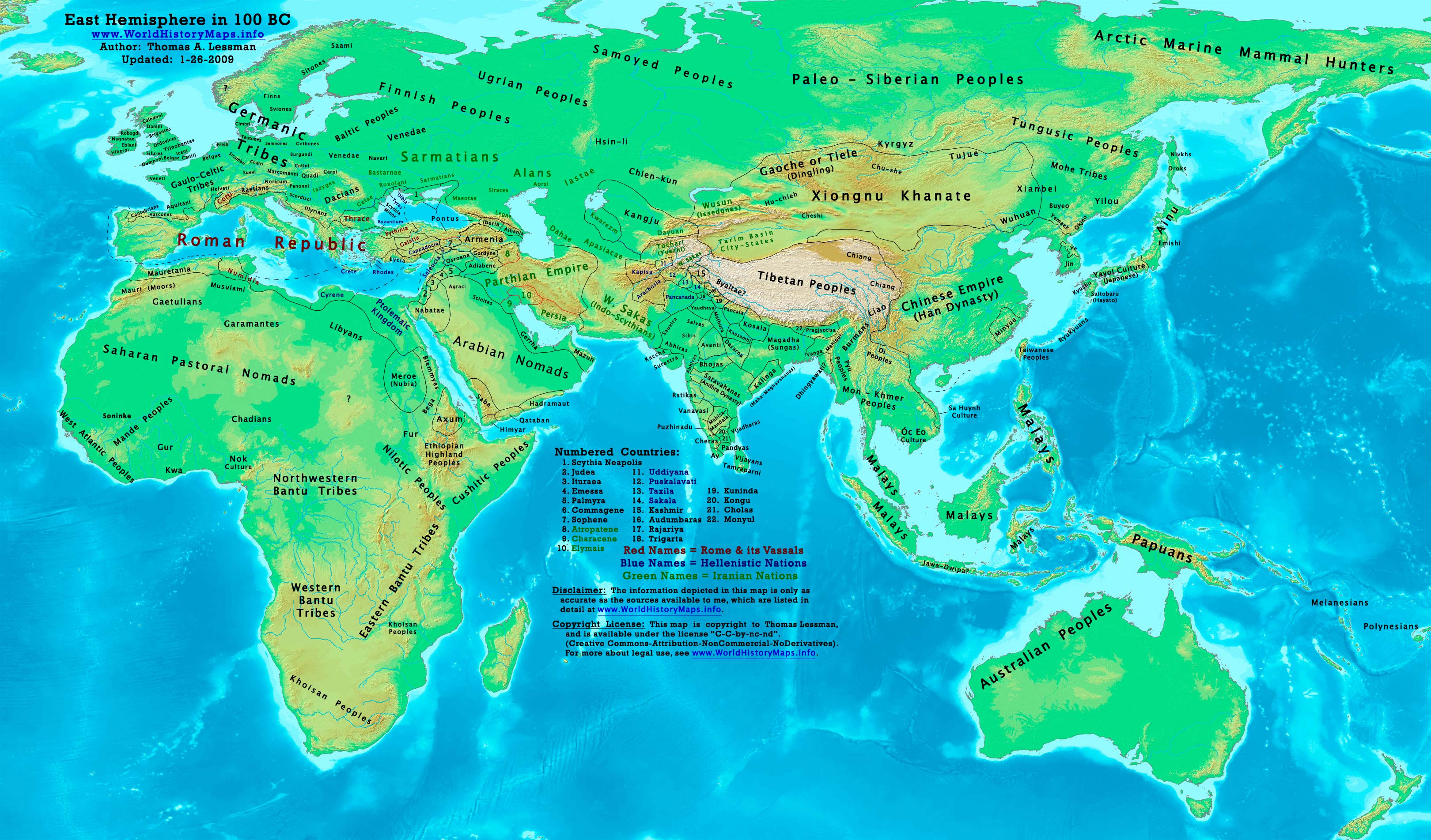
- East-Hem_100bc.jpg (JPEG Image, 3240×1903 pixels) – Scaled (33%)
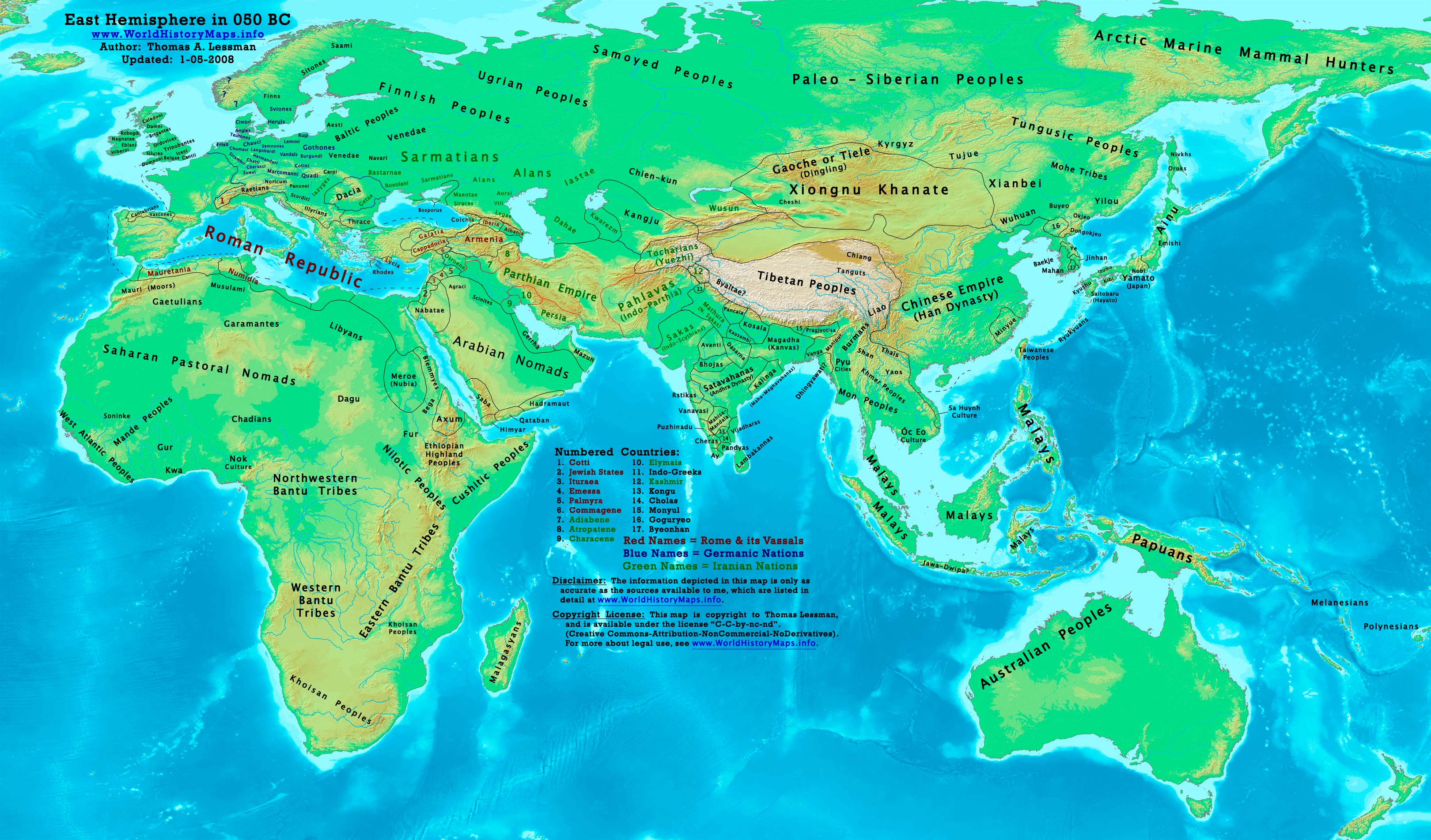
- East-Hem_050bc.jpg (JPEG Image, 3240×1903 pixels) – Scaled (33%)
- East-Hem_001ad.jpg (JPEG Image, 3240×1903 pixels) – Scaled (33%)
- East-Hem_050ad.jpg (JPEG Image, 3240×1903 pixels) – Scaled (33%)
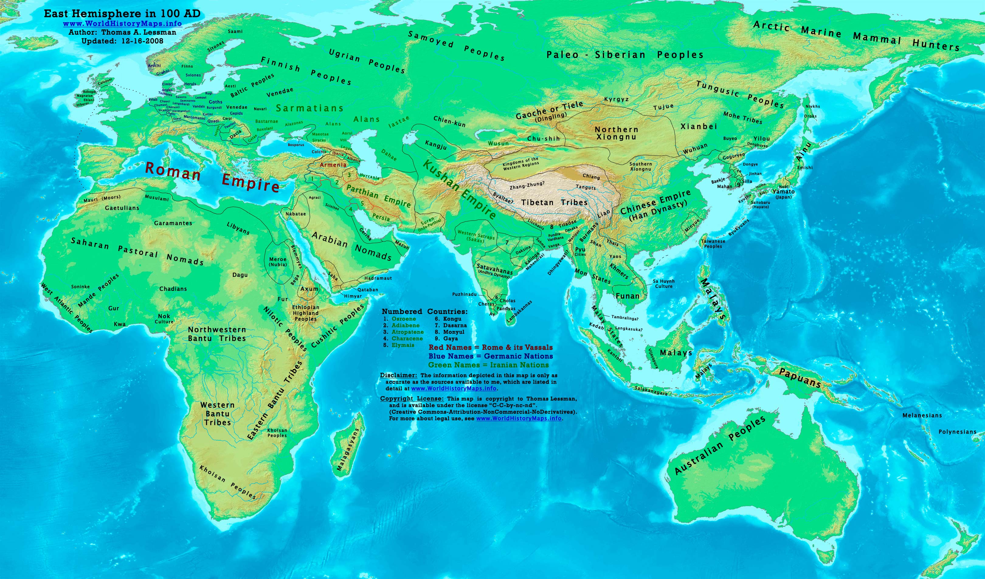
- East-Hem_100ad.jpg (JPEG Image, 3240×1903 pixels) – Scaled (33%)
TAL Online Maps
- ImageBulgaria 800ad.jpg – Wikipedia, the free encyclopedia
- ImageEast-Hem 200ad.jpg – Wikimedia Commons
- ImageEast-Hem 300ad.jpg – Wikimedia Commons
- ImageEast-Hem 323bc.jpg – Wikimedia Commons
- ImageOdoacer 480ad.jpg – Wikipedia, the free encyclopedia
- ImagePersia 600ad.jpg – Wikimedia Commons
- ImagePersia 600ad.jpg – Wikipedia, the free encyclopedia
- ImageRoman-Empire 200bc sm.jpg – Wikipedia, the free encyclopedia
- ImageRoman-Empire 565ad sm.jpg – Wikipedia, the free encyclopedia
- ImageRomans 477ad.jpg – Wikipedia, the free encyclopedia
- ImageTibet 700ad.jpg – Wikipedia, the free encyclopedia
- ImageTibet 800ad.jpg – Wikipedia, the free encyclopedia
- My watchlist – Wikimedia Commons
- UserTalessman – Wikimedia Commons
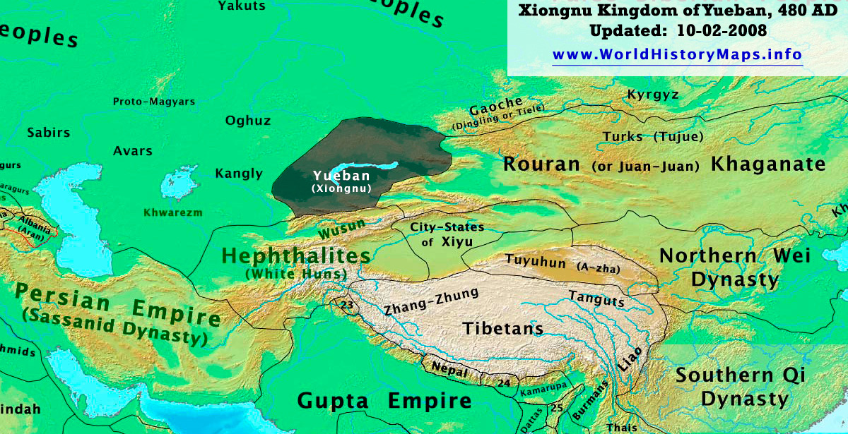
- Yueban_480ad.jpg (JPEG Image, 1200×615 pixels) – Scaled (83%)
Maps
Online Maps
- Huhai – 32.jpg
- Huhai – 30-31.jpg
- imageWorld 820.png – Wikimedia Commons
- http–ccat.sas.upenn.edu-~rs143-map3.jpg
- http–ccat.sas.upenn.edu-~rs143-map4.jpg
- Byzantine Libya Map
- Umayyad dynasty Libya Map
- Islamic Divisions – Libya Map
- Antiquite tardive -Sarmatie, Caucase, Pont-Euxin et mer Caspienne 460 AD
- Antiquite tardive -Sarmatie, Caucase, Pont-Euxin et mer Caspienne 420 AD
- Antiquite tardive -Pays nordiques et cote balte 460 AD
- World History Maps samples
- Earth View
- Free Printable Maps
- History & Commercial Atlas of China – Huhai
- Всемирная история The World History Maps (Russian)
- Columbia U. Maps overview_index (Columbia.edu)
- TurkicWorld – Maps Maps Maps
- Complete Map of Europe, Year 400
- Antiquite tardive -Pays nordiques et cote balte 380 AD
- Antiquite tardive -Germanie 380 AD
- Antiquite tardive -Nord de la Perse et mer Caspienne 380 AD
- World History Maps, Countries of the Old World 1-1-136 Historical Map
History Atlases
- Historical Atlas
- Ancient Atlas
- Atlas – Wikimedia Commons
- Classical Atlas Project
- Wikimedia Historical atlas
- Historical Atlas of the 20th Century
- Muir’s Historical Atlas – Google Search
- TimeMaps Atlas of World History
- USMA AtlasesTableOfContents
- Wikimedia Atlas of world history – Commons
- Tacitus Historical Atlas
- (Translated) Historical Atlas of Late Antiquity
- Historical Atlas of Late Antiquity by Dennis Beleme. (Translated version by Google).
- Digital South Asia Library (Schwartzberg Atlas)
Animated Atlases
- Histoire mondiale
- Home, History Atlas, An open-source application for reading and writing history
- World History HyperHistory
- YouTube – History map of East Asia for 2000 years
- The Genographic Project – Human Migration, Population Genetics, Maps, DNA – National Geographic
- National Geographic and IBM’s Genographic Project explores early human migration and deep ancestry via genetic markers that indicate haplogroups.
- NGS Atlas of the Human Journey – The Genographic Project
- National Geographic and IBM’s Genographic Project explores early human migration routes and describes the highlights along that journey.
- HistoAtlas – Main – The Historical Atlas
- The open historical geographical information system
- TimeMaps Atlas of World History
- This Free Atlas of World History provides a unique and fascinating overview of world history. Browse history with map-based timelines or explore in depth articles on a huge number of topics.
- The map as history : a multimedia atlas of world history with animated historical maps
- The map as history : a multimedia atlas of world history with animated historical maps
- Silk Road Seattle – Historical Atlas
- DIR Antique and Medieval Atlas
- Shepherd Historical atlas – Google Books
- Henlopen Historical atlas, 3800 B. C. to 1900 … – Google Books
Misc Map Links
- Best of History Web Sites Maps
- Historic Atlas Resource – Europe
- http–geocities.com-pak_history-maps.html
- Map of Mediterranean
- Mapping History
- Maps
Perry-Casteneda History Maps
- Asia Historical Maps – Perry-Castañeda Map Collection – UT Library Online
- Cambridge Modern History Atlas 1912 – Perry-Castañeda Map Collection – UT Library Online
- China Historical Maps – Perry-Castañeda Map Collection – UT Library Online
- Historical Map Web Sites – Perry-Castañeda Map Collection – UT Library Online
- Historical Maps – Perry-Castañeda Map Collection – UT Library Online
- Public Schools Historical Atlas by C. Colbeck – Perry-Castañeda Map Collection – UT Library Online
- World Historical Maps – Perry-Castañeda Map Collection – UT Library Online
- The History Cooperative E-Library Resources 2
- The History Cooperative E-Library Resources
- Imperial History
- CGRER NetSurfing: Maps and References
- Perry-Castañeda Historical Map links
- a MapClip (Good World Map)
- Ancient Maps Cover Page
- Ancient World Mapping Center
- Encyclopaedia Britannica
- Cultural Resources Historical Maps Overview
- Maps for Students (Egypt)
- NOAA-NGDC-MGG-GLOBE Project Get GLOBE Data Tiles
- templateMaps of world history – Wikimedia Commons
- KMLA World History
- World History Maps from Universal Maps
- WWW-VL History Index Maps
- IMPERIOS DE ASIA CENTRAL
- TurkWorld – Bulgar maps
- TurkWorld – Hun Maps
- National Geographic – Historical info & reference guide
- Medieval Sourcebook Maps
- History.com Maps
- Maps
- World History International: Maps
- A History of the World. A Collection Of World History Related Essays, Documents, Maps and Music From World History.
- ABZU Bibliography: Search Results
- Worlds Together Worlds Apart
- Worldmapper: The world as you’ve never seen it before
- Columbia U early_index Maps of S Asia
- Wiki category History maps
- paleoglot World Historical Maps Online
- World History/Maps – Wikibooks, collection of open-content textbooks
- Historia de las civilizaciones
- Historia de las Civilizaciones. Noticias, mapas, galería de imágenes, glosario y mucho más…
- 3CompMaps.html
- Aerial Photos, City Directories, & More Nationwide!
- HIG provides Historical Research for Environmental Professionals & other users. Aerial Photos, City Directories, & much more are available nationwide!
- Population through history maps
- Ancient World Maps (History-World)
- Online Map Creation
- Barrington atlas of the Greek and … – Google Books
- Welcome to Treehouse Maps
- Download Georeferenced Relief Maps and Free Decorative Maps
- Welcome to Avalon Maps
- Download digital world, continental, regional, decorative, and historical maps
- Quick Maps of the World – theodora.com – Flags, Maps, Economy, Geography, Climate, Natural Resources, Current Issues, International Agreements, Population, Social Statistics, Political System
- ABC Maps of the World – theodora.com – Interactive World Fact Book – Flags, Maps, Economy, Geography, Climate, Natural Resources, Current Issues, International Agreements, Population, Social Statistics, Political System
- Worldmapper: The world as you’ve never seen it before
- LinkExchangeOutsourcing – Maps
- Link exchange, an important part of search engine marketing is described here. Learn how to do link popularity in depth. Link building helps in faster indexing and more traffic. Have a look at the various ways in which link exchange can be done. Get complete information here.
- IAM Map Room
- Google Directory – Reference > Maps > Libraries
- Open Directory – Reference: Maps: Libraries
- Open Directory – Reference: Maps: Historical
- KU Libraries: Thomas R. Smith Map Collection
- Centennia Historical Atlas — Europe and the Middle East 1000AD to the Present, software for Windows and Mac OSX
- BOTW Directory – Reference > Maps > Historical Maps
- A website offering hand rated information about Historical Maps. A world of discovery with the best information sources,Helping you research with the best internet knowledge resources.
- Historical Maps – AT&T Yahoo! Search Results
- AlltheWeb.com: Web results for “Historical Maps”
- AlltheWeb.com: Web results for “Historical Maps”
- Image:Tutorial-cartography (basic).svg
- Historic Earth™
- United States Property Atlases, Old maps, rare maps, Nautical Charts, Directories, antique maps, antiquarian maps, charts, and illustrations of .
- Historic Map Works, Residential Genealogy ™
- World’s largest online historical map resource. Historical American maps, illustrations, charts and antique maps.
History eBooks
- The Cambridge Ancient History: The … – Google Books
- Intro to the Ancient World – Google Books
- Rome and the Mediterranean to 133 B.C. – Google Book Search
- Rome and the Mediterranean to 133 B.C. – Google Book Search
- Introduction to the Ancient World – Google Books
- The Hellenistic World and the Coming … – Google Book Search
- A History of Ancient Greek: From the … – Google Book Search
- History of Civilizations of Central Asia – Google Book Search
- Bactria, the History of a Forgotten … – Google Book Search
- Inner Eurasia from Prehistory to the … – Google Book Search
- The Greeks in Bactria & India – Google Book Search
- The Greeks in Bactria & India – Google Book Search
- Inner Eurasia from Prehistory to the … – Google Book Search
- The Historians’ History of the World – Google Book Search
Timelines
- geocities.com-Athens-Academy-history2.html
- TimeSearch History ::Home
- Chronology of World Political History
- This chronology outlines the political development of the nations in the world with the illustrations of certain historical figures.
- World Timelines – Home
- Timelines.Info – Graphical Timelines of World History
- Graphical Timelines covering a range of World History
- WikiTimeScale – Graph
- Histroycart Timeline
- Parthian Timeline of Ancient World Events
- Timeline of Ancient World Events with a Partho-centric perspective
- Timelines of History, Today in History, World History
- World History in timeline form from the Big Bang. Also Today in History.
- EAWC: The Complete Chronology
Other History
Alt-Hist
- Alternative History is a database that anyone can edit.
- Welcome to the Alternate History Travel Guides!
- A listing of travel guides to worlds of Might Have Been.
- Alternate History in the Yahoo! Directory
- Yahoo! reviewed these sites and found them related to Alternate History
- AlternateHistory.com
- Alternate History Discussion Board
- Hall of Maat – Current Active Topics
- Discussing Alternative Archaeology, Science and History
History Forums
- About Medieval History Forum
- Welcome to the Medieval History forum! My name is Melissa Snell, and I’m the About.com Guide to Medieval History and the moderator of this forum. Please feel free to ask a question, post an idea, or launch a discussion on any topic connected to the Middle Ages, and don’t be shy about joining conversations that have already started! All I ask is that you abide by our f orum guidelines for a friendly exchange. This forum is part of the About Medieval History site, where you can find a great variety of information about the Middle Ages. Visit our home page for introductory information, in-depth resources, and news related to medieval topics.
- Shadowed Realm – Medieval History Forum
- Message Boards in History Channel
- Terms of Service
- History International in History Channel
- HISTORY CHANNEL INTERNATIONAL is devoted to international topics and brings viewers a unique, in-depth understanding of the world around them. HISTORY CHANNEL INTERNATIONAL is the one place that puts historical facts and events in fresh focus, offering a more specific appeal to the history enthusiast. It is global history, compelling, and connected.
- MapHist Discussion Group
- MapHist, the Map History Discussion List, is an e-mail discussion group whose primary focus is historical maps, atlases, globes and other cartographic documents. The list is open to all persons interested in the history of cartography and discussion is encouraged on all aspects of this broad subject.
- Armchair General and HistoryNet >> The Best Forums in History
- This is a discussion of all things military history and wargaming.
- Categories – Ancient Warfare forum – Ancient-Warfare.com, the online home of Ancient Warfare magazine
- Ancient-Warfare.com, the home of Ancient Warfare magazine. Categories – Ancient Warfare forum
- History Empire Forums – Powered by vBulletin
- This is a discussion forum powered by vBulletin. To find out about vBulletin, go to https://www.vbulletin.com/ .
Wiki History
4-15-07
- Anatolian Turkish Beyliks – Wikipedia, the free encyclopedia
- Bashkirs – Wikipedia, the free encyclopedia
- Byzantine Empire
- Danishmends – Wikipedia, the free encyclopedia
- Empire of Nicaea – Wikipedia, the free encyclopedia
- Empire of Trebizond – Wikipedia, the free encyclopedia
- Halych-Volhynia – Wikipedia, the free encyclopedia
- History of the Turkic peoples – Wikipedia, the free encyclopedia
- Hungarian prehistory – Wikipedia, the free encyclopedia
- Hutsuls – Wikipedia, the free encyclopedia
- Iazyges – Wikipedia, the free encyclopedia
- Iranians – Wikipedia, the free encyclopedia
- Karamanoğlu – Wikipedia, the free encyclopedia
- Lędzianie – Wikipedia, the free encyclopedia
- Maurice (emperor) – Wikipedia, the free encyclopedia
- Moesia – Wikipedia, the free encyclopedia
- Ottoman Dynasty – Wikipedia, the free encyclopedia
- Public domain – Wikipedia, the free encyclopedia
- Roman Empire – Wikipedia, the free encyclopedia
- Romania in the Early Middle Ages – Wikipedia, the free encyclopedia
- Saltovo-Mayaki – Wikipedia, the free encyclopedia
- Sassanid Empire – Wikipedia, the free encyclopedia
- Second Bulgarian Empire – Wikipedia, the free encyclopedia
- Seljuq dynasty – Wikipedia, the free encyclopedia
- Slavic peoples – Wikipedia, the free encyclopedia
- Sultanate of Rûm – Wikipedia, the free encyclopedia
- Turkic migration – Wikipedia, the free encyclopedia
- Turkmen people – Wikipedia, the free encyclopedia
- Western Roman Empire – Wikipedia, the free encyclopedia
TAL-Wikis
- ImagePersia 600ad.jpg – Wikipedia, the free encyclopedia
- My watchlist – Wikipedia, the free encyclopedia
- TemplateWorld History Maps – Wikipedia, the free encyclopedia
- User talkTalessman – Wikimedia Commons
- UserTalessman – Wikimedia Commons
- UserTalessman – Wikipedia, the free encyclopedia
- UserTalessman-Maps – Wikipedia, the free encyclopedia
Wiki History Maps
- Atlas-Templates – Wikimedia Commons
- CategoryAtlas templates – Wikimedia Commons
- CategoryCommons templates – Wikimedia Commons
- CategoryHistorical maps by UserBriangotts – Wikipedia, the free encyclopedia
- CategoryHistorical maps by William R. Shepherd – Wikipedia, the free encyclopedia
- CategoryMaps of the history of Asia – Wikipedia, the free encyclopedia
- CategoryMaps of the history of Europe – Wikipedia, the free encyclopedia
- CategoryMaps of the Macedonian Empire – Wikipedia, the free encyclopedia
- CategoryMaps of the world showing history – Wikimedia Commons (2)
- CategoryNavigational templates – Wikimedia Commons
- CategoryWorld History Maps – Wikimedia Commons
- Colin McEvedy – Wikipedia, the free encyclopedia
- Commons talkPicture requests – Wikimedia Commons
- Editing TemplateMaps of world history – Preview – Wikimedia Commons
- Editing TemplateWorld History Maps – Preview – Wikimedia Commons
- ImageEurope1328ujabb.jpg – Wikipedia, the free encyclopedia
- ImageEuropein1328.png – Wikipedia, the free encyclopedia
- My watchlist – Wikimedia Commons
- TemplateHistorical blank world maps – Wikimedia Commons
- TemplateMaps of world history – Wikimedia Commons
- TemplateWorld History Maps – Wikimedia Commons
- WikipediaWikiProject Former countries – Wikipedia, the free encyclopedia
Wiki World History Book
- Ancient History – Wikibooks, collection of open-content textbooks
- European History – Wikibooks, collection of open-content textbooks
- European History-Contents – Wikibooks, collection of open-content textbooks
- wikipediaWikiProject History
- wikipediaWikiProject Middle Ages
- World History-Human evolution and prehistory – Wikibooks, collection of open-content textbooks
- World History-Maps – Wikibooks, collection of open-content textbooks
- World History-The Roman Empire – Wikibooks, collection of open-content textbooks
Wiki-Tools
- Annual C$E Data Report Table 9, 2007
- CheckUsage
- commonsFirst steps-File transfer and tools – Wikimedia Commons
- HelpA quick guide to templates – Meta
- helpArchiving a talk page – Wikipedia, the free encyclopedia
- helpContents – Wikimedia Commons
- helpContents-Site map – Wikipedia, the free encyclopedia
- HelpEditing – Meta
- HelpStarting a new page – Meta
- HelpTemplate – Meta
- http–tools.wikimedia.de-~magnus-add_information.php
- http–tools.wikimedia.de-~magnus-commonshelper.php
- Magnus’ toys’n’tools
- MetaList of templates – Meta
- My watchlist – Wikipedia, the free encyclopedia
- Templates of Wikimedia projects – Meta
- Wikimedia Gallery
- wikipediaCheatsheet – Wikipedia, the free encyclopedia
- wikipediaUser page – Wikipedia, the free encyclopedia
- wikipediaUserboxes – Wikipedia, the free encyclopedia
- wikipediaWikiProject Maps – Wikipedia, the free encyclopedia
- Wiki Historiography
- History – Wikis from Wikia – Join the best wiki communities
- The History Wikia is composed of historical data. All and any history may be included. Users are encouraged to contribute based on their knowledge on a subject.
- Category:Hubs – Wikis from Wikia – Join the best wiki communities
- Home Page
- Wikipedia:OTRS
- Wikipedia:Possibly unfree images
History Link Databases
- Byzantine and Medieval Web Links
- Perry-Castañeda Historical Map Web Sites
- maproom.org FAQ
- Society for Late Antiquity
- vos History Links
- www-vl History Index Maps
- WWW-VL Medieval Europe
- CSEN Linked Sites
- Links – Proto-Bulgarians, Central Asia, etc.
- WWW-VL: World History Index and History Central Catalogue
- This is the central catalogue for the
- Xenohistorian Favorite Links
- The ever-growing list of my favorite links.
- EDSITEment – Websites
- Links to World History Document Sources
- Best of History Web Sites Maps
- Historical Maps by History Link 101
- Historical Maps – UT Library Online
- Historical Atlas of the 20th Century — Links to other history maps
- OCEAN index to the best online content
- OCEAN indexes the best history content on the net.
- Affiliates of the World History Association
- Other Maps Relating to Islam’s Historical Development
- Historical Maps truls tripod
- Historical Studies Resources ias-edu
- Librarians’ Internet Index History
- SAU Library – History Resources
- SAU Library-Best Information on the Net – History Resources
- Historical Maps – Yahoo! Search Results
- History in the Yahoo! Directory
- Explore history through sites offering articles, personal accounts, documents, timelines, photographs, and biographies. Includes sections on major historical periods, genealogy, living history, archaeology, and museums.
- Historical Resources – fanaticus-org
- Oddens’ Bookmarks – links to maps and mapping
- History links (OrangeUSD)
- KS CHE World History
- World History – Virtual Middle School Library
- WorldHistoryMaps-com Links page
- We have historical maps of the entire world, one for each year, showing countries of the world for every year in recorded history.
- Resources
- UCLA NELC Department website
- Internet Public Library: Social Sciences
- The Internet Public Library (IPL) features a searchable, subject-categorized directory of authoritative websites; links to online texts, newspapers, and magazines; and the Ask A Question online reference service.
- History (EduRef)
- Best of History Web Sites
- Best of History Web Sites contains annotated links to over 1000 history web sites as well lesson plans, activities, and more
- Internet Public Library: History
- The Internet Public Library (IPL) features a searchable, subject-categorized directory of authoritative websites; links to online texts, newspapers, and magazines; and the Ask A Question online reference service.
- Best of History Web Sites
- Best of History Web Sites contains annotated links to over 1000 history web sites as well lesson plans, activities, and more
- WWW-VL: World History Index and History Central Catalogue
- This is the central catalogue for the
- Discovery Ed Social Studies links
- A resource provided by Discovery Education to guide students and provide Social Studies Homework help to students of all grades.
- Websites for Historians : Historical Studies : University of Leicester
- School of Historical Studies, University of Leicester, United Kingdom. A School acclaimed for its research and teaching, delivering high quality courses to undergraduate and postgraduate students, and contributing to major historical research in a wide range of areas.
- History On-Line gateway links
- History Guide NG Database
- AcademicInfo Subject Guides
- Intute – History Resources links
- Intute – History
- The History Ring history, reference, research, literature, recollection, saga, story, encyclopedia, past, historian,
- This ring celebrates History, historical events, figures and fields. This Ring is designed to be seen by all ages. You must have detailed historical information, or links to sites which do, on your we
- Intute – History
- Intute browse results
- Center for History and New Media
- Center for History and New Media – Tools
- Google Language Tools
- FSmitha Macrohistory – World Timeline
- Developments from 65,000 to yesterday listed in one or a few sentences, sometimes giving background.
- AIR POWER AT SEA
- Battleships Carriers And All Other Warships
- Castles of the World
- Internet Resources for World History
- Obsidian’s Lair
- Signers of the Declaration
- The Lost Gospel Book Review by Laura Knight-Jadczyk
- Lost Civilizations Uncovered
- PC Games and the Teaching of History
- EAWC Internet Index
- Applied History Research Group – Multimedia History Tutorials
- DNA study of human migration / National Geographic and IBM investigate spread of prehistoric peoples around world
- NGS: New 7 Wonders vs. Ancient 7 Wonders
- Picture Gallery of the seven new wonders of the world and the seven ancient wonders.
- NCHE Home
- World Statesmen.org
- All Empires – Suggestion Box – Page 1
- USA Stonehenge
- Register New Site At All History Guide Directory
- Ethnography
- History On-Line
- LexiLine Index – History of Civilization – A Renaissance in Learning
- History of Civilization – A Renaissance in Learning – LexiLine.com Index Page
- History House Online
- …
- Royalty.nu – The World of Royalty – History, News, Books
- Royal news, history, books, and links, including British royalty, Princess Diana, Prince William; world royalty, past and present.
- NiceFacts – History Facts
- DNA Tribes Personal Genetic Analysis
- Footnotes to History- by James L. Erwin
- LacusCurtius • Ptolemy’s Geography — Book II, Chapter 2
- Racial Myths – Exploding Myths About Race and Racial Origins
- Rulers of the World
- CasaHistoria – Imperialism
- links to 19th and 20th century imperialism
- The History Cooperative
- History Cooperative
- Public Historian
- Encyclopaedia Britannica
- Muir’s Historical Atlas – Google Search
- SCORE History-Social Science Browse Resources by Grades
- Historical Map of China, Northern Wei – Google Image Search
- The Dying God: The Hidden History of Western Civilization
- The Dying God: The Hidden History of Western Civilization
- Shambala research
- WikiTimeLine
- Wiki List of timelines
- 5 Epochs of Civ – Table of Contents
- Eleven chapters of Five Epochs of Civilization
- Atlas of World History museum home
- World History in General
- These links are general or comprehensive in nature. For more specific links, check the separate subject listings.
- Home
Misc History
- The History Channel – Home Page
- The History Channel is a cable television station offering programming related to historical events and people.
- NGS Mysteries of the Ancient World, Photos, Facts
- Mysteries of the Ancient World, Photos, Facts, Information — National Geographic
- The World in History Channel
- The World
- Online History Degrees
- Find online History degree programs and learn more about earning accredited History degrees through distance education.
- History Timelines and Articles
- EDSITEment – History Social Studies Lesson Plans
- UH Press Journals: Journal of World History
- Books and journals published by the University of Hawaii Press available in our Online Store.
- Bridging World History
- Bridging World History: World History Travel
- casahistoria home
- home page of casahistoria for modern history links
- ABC-CLIO Complete History Reference
- World History Center at NEU
- World History Center
- Pittsburgh U: Department of History
- World History Center – Pittsburgh University
- UC Santa Cruz, Center for World History – Home
- Page Description Goes here
- “World History Center” – Google Search
- AAWH: The Asian Association of World Historians
- Research Institute for World History (Japan)
- European Network in Universal and Global History (ENIUGH)
- Department of History, University of Warwick
- Department of History University of Warwick
- geschichte.transnational
- geschichte.transnational
- National Coalition for History
- WorldHistory.org
- WorldHistory
- The Best World History Resources for Teachers on the WWW
- World History/Contents – Wikibooks
- World History – Wikibooks
- World History Intl: Essays From Prehistory To Present
- A History of the World. A Collection Of World History Related Essays, Documents, Maps and Music From World History.
- World History Maps – Yahoo! Search Results
- world history – Google Search
- The Theroff Files
- A collection of royal genealogy files.
- Internet Guide for History: Ancient History
- History International
- Military History Channel
- World History for the Relaxed Historian
- World History in a Nutshell. The big picture. A sum up of historical people and events. An abundance of concise history articles on British, American, and World History.
- The educational encyclopedia, all about history, Anthropology, Archaeology, Paleontology, Holocaust
- The educational encyclopedia, all about history, Anthropology, Archaeology, Holocaust, Paleontology
- Library Users Guide World History
- Downloads – Creative Commons
- Creative Commons licenses provide a flexible range of protections and freedoms for authors, artists, and educators.
- Creative Commons Attribution-Noncommercial-No Derivative Works 3.0 Unported
- National Geographic Map Store – Atlases Family, Reference, and Travel Atlases
- National Geographic – Planet, History, etc
- National Geographic provides free maps, photos, videos and daily news stories, as well as articles and features about animals, the environment, cultures, history, world music and travel.
- Barbara R. von Schlegell Web Resources Maps
- Burnt Cakes – History teaching, lesson plans and resources
- burnt cakes is a website for History teachers it includes lesson plans, reviews and other history teaching resources
- HistoryOrb.com – Articles, Papers & Today in History
- History articles, papers and today in history. Our archives contain important and famous events, birthdays and deaths from 6,000 years of history.
- PBS | History
- This Web site, provided by the Public Broadcasting Service (PBS), is home to more than 350 television show companion sites in addition to Web-original sites. PBS Online hosts interactive content for everyone — including kids, parents, educators, and the general audience.
- Encyclopaedia of the Orient
- History & Cultures – History section
- Webpages of a Doctor in history, with many links about history, for students and research in humanities
- Howstuffworks “History”
- The HowStuffWorks History section chronicles the history of world regions. Take a comprehensive look at the past in HowStuffWorks History.
- WorldHistorySite.com: Links to other websites
- Links to other websites
- Wiki Portal – Time
- Wiki Portal – History
- WordNet Service Unavailable
- Dates of History – Index of World History Events and Dates
- Wikibooks history textbooks
- Wikipedia – Topic outline of history
- AllRefer.com – History Encyclopedia
- AllRefer.com reference and encyclopedia resource provides encyclopedia articles covered under this topic.
- history forum – topeka forums – craigslist
- Synoptic table of the principal old world prehistoric cultures – Wikipedia, the free encyclopedia
- Andaman The Andamanese
- All aspects of the world’s oldest human population living on isolated islands in the Bay of Bengal. They and their civilization go back to the original human migration out of Africa over 100,000 years ago.
- Y-DNA haplogroups by ethnic groups – Wikipedia, the free encyclopedia
- Armenian History Workshop
- Greek and Roman Historians
- Rulers
- Midwest World History Association
- A history of inner Asia – Google Books
- Historycenetral.com- History’s Home on the Web
- Historycentral.com is your one source for everything on American History and World History. Special sections on: Americas Wars, American Presidential elections, Civic, Aviation History, The Sixties,and much more.
8-12-09
- Letter: Public wants option | CJOnline.com
- history – Google Search
- Category:History – Wikipedia, the free encyclopedia
- History in the Yahoo! Directory
- Institute of Historical Research | The national centre for history
- Librarians’ Internet Index Islam & the Islamic Empire
- Librarians’ Internet Index Ancient History
- Librarians’ Internet Index History
- Welcome
- World History : HyperHistory
- HWC, Medieval Europe
- Medieval Sites on the Web
- NetSERF: The Internet Connection for Medieval Resources
- Hephthalites – Google Search
- Google Image Result for https://www.worldhistorymaps.info/images/Yueban_480ad.jpg
- Google Image Result for http://www.indiabuzzing.com/wp-content/uploads/hephthalites_500ad.jpg
- The Hephthalites of Central Asia – by Richard Heli
- Links – Proto-Bulgarians, Central Asia, etc.
- The Proto-Bulgarians north and west of the Black Sea
- Thracian language – Index
- Turkic Republics and Communities – Turks, Turkish, Turk
- Iranian Cultural & Information Center
- OXUS COMMUNICATIONS
- THE CENTRAL ASIAN PAGES
- Waugh’s Central Asia
- Guide To THL Resources
- Usborne Quicklinks: Quicklinks Worldwide
- Usborne Quicklinks – internet linked books from Usborne Publishing.
- Timelines of History, Today in History, World History
- World History in timeline form from the Big Bang. Also Today in History.
- HistoryNet – From the World’s Largest History Magazine Publisher
- HistoryNet.com is the home of Weider History Group, the world’s largest history magazine publisher, with content from ten history and military history titles such as World War II, Military History, Vietnam, America’s Civil War, MHQ, and many more.
- National Geographic – History
- Historyteacher.net
- BBC – History
- The home of history on the BBC
- Free History
- Open Directory – Society: History
- GUIDE TO HISTORY ON THE WEB
- History | The WWW Virtual Library | Dr. Lynn H. Nelson original WWW-VL: History site | www.vlib.us
- The original WWW VL history directory of the WWW-Virtual Library, an expert-run catalog of sections of the web.
- AlltheWeb.com: Web results for “world history maps”
- Make History
- World Civilizations Reader
- Best of History Web Sites
- Best of History Web Sites contains annotated links to over 1000 history web sites as well lesson plans, activities, and more
- HistoryBuff.com
- Extensive Web site focusing primarily on how newspapers and the press covered major, and not so major, events in American history. Also information for newspaper collectors.
- Great History | The Best Blogging in History : Great History
- Great History highlights the best and brightest history bloggers on the Internet today. We specialize in how history affects current events.
History 8-08-09
- /#hl=en&safe=off&num=100&newwindow=1&q=%22Colin+McEvedy%22&aq=&oq=&aqi=&aq=f&oq=&aqi=&fp=avu4sPcvQUY
- early_index
- Alexander the Great – Wikipedia, the free encyclopedia
- history_shepherd_1923.html
- Generic_Mapping_Tools
- map.htm
- /~gov46/
- web
- IMPERIOS%20DEL%20INDOSTAN.htm
- Map Links
- Colin McEvedy – Wikipedia, the free encyclopedia
- Japan History with Western Calendar (mnsu emuseum)
- Ancient India: Contents (wsu)
- Ancient Indus Valley and the British Raj (Harappa)
- The story of the ancient Indus Valley and glimpses of India and Pakistan before 1947 during the Raj. Old photographs, rare archival film footage and long unseen media from before independence in India and Pakistan in 2,000 photo pages.
- Persian History – Iranian Cultural & Information Center