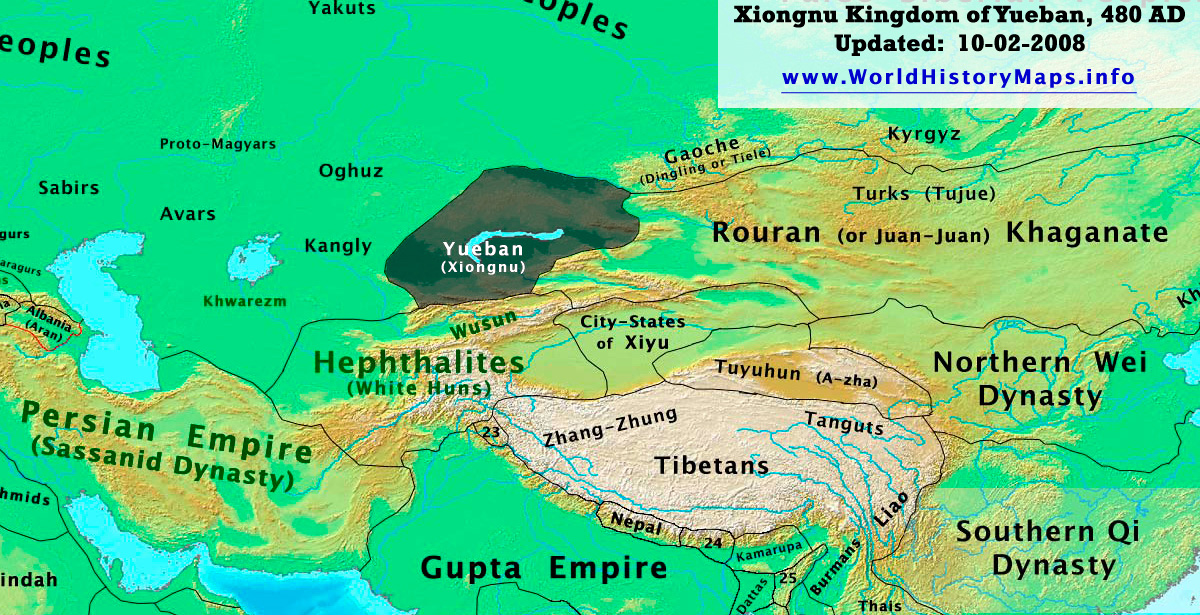
https://www.worldhistorymaps.info/wp-content/uploads/2021/03/yueban_480ad.jpg
Yueban (Chinese: 悅般) (Middle Chinese: */jiuᴇt̚-pˠan/ < Late Han Chinese: */jyat-pɑn/), colloquially: “Weak Xiongnu”, was the name used by Chinese historians for remnants of the Northern Xiongnu in Zhetysu, now part of modern-day Kazakhstan. In Chinese literature they commonly called Yueban. The Yuebans gained their own visibility after disintegration of the Northern Xiongnu state, because unlike the main body of the Northern Xiongnu, who escaped from the Chinese sphere of knowledge, the Yueban tribes remained closer to China.
The Yueban emerged after the disintegration of the Xiongnu confederation. They underwent a strong influence of the Sogdian culture. About 480s, the Yueban split into four Chuy tribes: Chuyue (處月), Chumi (處密), Chumukun (處木昆), and Chuban (處半).
One Yueban branch, Chuyue, later intermixing with Göktürks, formed the Shatuo of the Western Göktürk Khaganate. The Yueban-descended Shatuo played an important role in Chinese dynastic history. In the 10th century the remaining Shatuo branch of the Chuy tribe possibly joined Mongolic-speaking Tatar confederation in the territory of the modern Mongolia, and became known as Ongud or White Tatars branch of the Tatars.
Another Yueban-descended tribe, Chumukun, might be associated with the Kimek confederation.
Source: Wikipedia