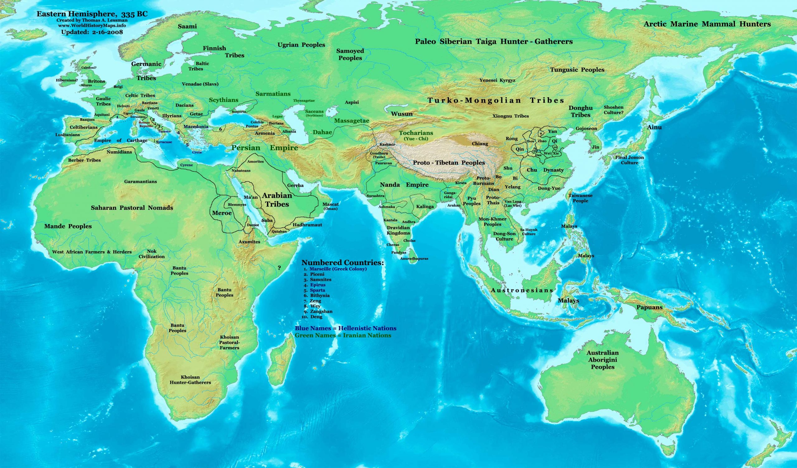
https://www.worldhistorymaps.info/wp-content/uploads/2021/03/map-335bc.jpg
Primary Sources for East-Hem_335bc.jpg:
- The DK Atlas of World History. 2000 edition. (See specific references below)
- John Nelson. Interactive Historical Atlas of the World since 500BCE. Map of the “Countries of the World 1/1/335 BCE.”
World History Maps Inc., Alexandria, VA, 2008. Available at www.WorldHistoryMaps.com.
I – African information:
* African Tribal locations are derived from:
- The DK Atlas of World History. Map of “The Development of Complex Societies in Africa”. Pg 160.
(Bantus, Berber Tribes, Chadians, Cushites, Daamat, Garamantes, Gur, Khoisan Peoples, Kwa, Libyans, Mandes,
Nilotic Peoples, West Atlantic Peoples, etc.)
II – Asian information:
* East Asian (Chinese area) information is from:
- The DK Atlas of World History. Map of “Zhou China, 1027-403 BCE”. Pg 259.
- Albert Herrmann, Ph.D. History & Commercial Atlas of China. Map of “The Contending States Boundries c. 350 BC”.
* Greater India (Including modern Bangladesh, India, and Pakistan):
- The DK Atlas of World History. Map of “The Nanda and Mauryan Empires, 365-181 BCE ”. Pg 241.
- Joseph Schwartzberg. The Historical Atlas of South Asia. Map of “The Achaemenid Empire and the Magadhan Empire“.
* Korean & Manchurian information:
- Park Hyeon. Map of “History_of_Korea_300_BC.png”. Available on Wikipedia.
Note: Much of the information in this map was cross-checked with Bruce Gordon’s Regnal Chronologies.
335 BC – Alexander destroys the city of Thebes and divides its territory between the other Boeotian cities after rebellion against Macedon rule
335 BC – Aristotle, a Greek philosopher and polymath, opens the Lyceum, a gymnasium named after the god of the grove Apollo Lyceus
Source: historystack.com